
Topografische Karte Cirencester
Interaktive Karte
Klicken Sie auf die Karte, um die Höhe anzuzeigen.
Über diese Karte
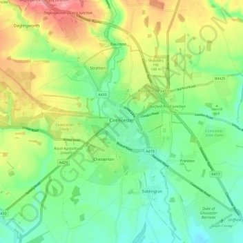
Name: Topografische Karte Cirencester, Höhe, Relief.
Durchschnittliche Höhe: 128 m
Minimale Höhe: 89 m
Maximale Höhe: 194 m
On Cotswold Avenue is the site of a Roman amphitheatre which, while buried, retains its shape in the earthen topography of the small park setting. Cirencester was one of the most substantial cities of Roman-era Britain.