
Topografische Karte Chariton
Interaktive Karte
Klicken Sie auf die Karte, um die Höhe anzuzeigen.
Über diese Karte
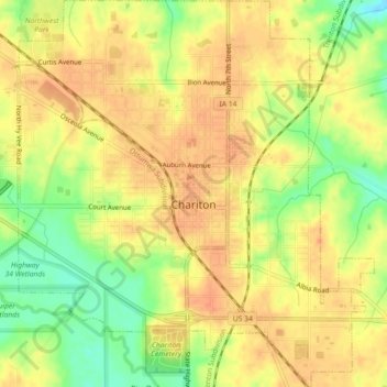
Name: Topografische Karte Chariton, Höhe, Relief.
Ort: Chariton, Lucas County, Iowa, 50049, United States (40.99870 -93.32778 41.03258 -93.28640)
Durchschnittliche Höhe: 308 m
Minimale Höhe: 279 m
Maximale Höhe: 323 m
The Lucas County Courthouse is the highest point of elevation in the whole town and is located on the Missouri/Mississippi River Divide.