
Topografische Karte Falls Creek
Interaktive Karte
Klicken Sie auf die Karte, um die Höhe anzuzeigen.
Über diese Karte
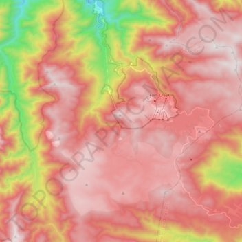
Name: Topografische Karte Falls Creek, Höhe, Relief.
Durchschnittliche Höhe: 1.459 m
Minimale Höhe: 629 m
Maximale Höhe: 1.892 m
The Falls Creek Alpine Resort is an alpine ski resort in the Hume region in northeastern Victoria, Australia. It is located in the Alpine National Park in the Victorian Alps, approximately 350 kilometres (220 miles) by road from Melbourne, with the nearest town Mount Beauty, approximately 30 km (20 mi) away. The resort lies between an elevation of 1,210 and 1,830 m (3,970 and 6,004 ft) above sea level, with the highest lifted point at 1,780 m (5,840 ft). Skiing is possible on the nearby peak of Mount McKay at 1,842 m (6,043 ft), accessed by snowcat from the resort.