
Topografische Karte Blackheath
Interaktive Karte
Klicken Sie auf die Karte, um die Höhe anzuzeigen.
Über diese Karte
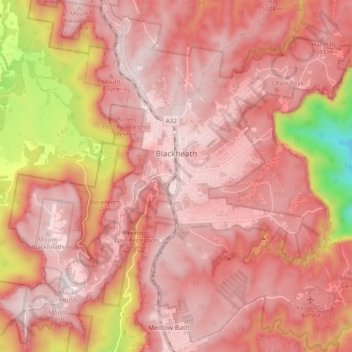
Name: Topografische Karte Blackheath, Höhe, Relief.
Durchschnittliche Höhe: 914 m
Minimale Höhe: 376 m
Maximale Höhe: 1.101 m
As the highest town in the Blue Mountains, Blackheath receives snow in winter (two settled falls per season is the average with another five to ten days of light snow showers) and even in summer the temperatures are generally mild in comparison to other locations at the same latitude. Average maximum temperature in winter is around 9 to 10 °C (48 to 50 °F) although some days struggle to get above 5 to 6 °C (41 to 43 °F). Frosts are fairly common but not as common or strong as frosts on the Oberon Plateau or in places further west, like Bathurst and Orange. Local topography tends to keep minimum temperatures in the −3 to 5 °C (27 to 41 °F) range as the coldest air during radiative cooling (clear, calm nights) drains into the valleys.