Topografische Karte Fish Lake
Interaktive Karte
Klicken Sie auf die Karte, um die Höhe anzuzeigen.
Über diese Karte
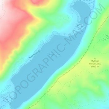
Name: Topografische Karte Fish Lake, Höhe, Relief.
Durchschnittliche Höhe: 2.886 m
Minimale Höhe: 2.694 m
Maximale Höhe: 3.438 m

Klicken Sie auf die Karte, um die Höhe anzuzeigen.
Name: Topografische Karte Fish Lake, Höhe, Relief.
Durchschnittliche Höhe: 2.886 m
Minimale Höhe: 2.694 m
Maximale Höhe: 3.438 m