
Topografische Karte City of Ekurhuleni Metropolitan Municipality
Interaktive Karte
Klicken Sie auf die Karte, um die Höhe anzuzeigen.
Über diese Karte
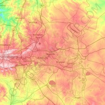
Name: Topografische Karte City of Ekurhuleni Metropolitan Municipality, Höhe, Relief.
Durchschnittliche Höhe: 1.588 m
Minimale Höhe: 1.360 m
Maximale Höhe: 1.808 m
Andere topografische Karten
Klicken Sie auf eine Karte, um ihre Topografie, ihre Höhe und ihr Relief anzuzeigen.
Kempton Park
Südafrika > Gauteng > City of Ekurhuleni Metropolitan Municipality
Durchschnittliche Höhe: 1.654 m