
Topografische Karte Posen
Interaktive Karte
Klicken Sie auf die Karte, um die Höhe anzuzeigen.
Posen
In den ersten Jahren der preußischen Herrschaft hatten die polnischen Einwohner die gleichen Rechte wie die preußischen. Die Gleichbehandlung galt auch der Sprache, sodass das Polnische in Schulen und Behörden gebraucht wurde, obwohl man sich bemühte, den Anteil der deutschen Bevölkerung durch Begünstigungen bei der Ansiedlung zu erhöhen.
Über diese Karte
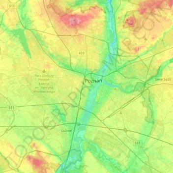
Name: Topografische Karte Posen, Höhe, Relief.
Ort: Posen, powiat poznański, Woiwodschaft Großpolen, Polen (52.29192 16.73159 52.50933 17.07171)
Durchschnittliche Höhe: 85 m
Minimale Höhe: 45 m
Maximale Höhe: 146 m