
Topografische Karte Brazzaville
Interaktive Karte
Klicken Sie auf die Karte, um die Höhe anzuzeigen.
Über diese Karte
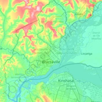
Name: Topografische Karte Brazzaville, Höhe, Relief.
Ort: Brazzaville, Brazzaville (département), Republik Kongo (-4.38105 15.13895 -4.09677 15.32480)
Durchschnittliche Höhe: 319 m
Minimale Höhe: 246 m
Maximale Höhe: 576 m