
Topografische Karte Hirschberg
Interaktive Karte
Klicken Sie auf die Karte, um die Höhe anzuzeigen.
Über diese Karte
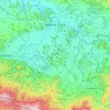
Name: Topografische Karte Hirschberg, Höhe, Relief.
Ort: Hirschberg, Woiwodschaft Niederschlesien, Polen (50.76777 15.57787 50.93256 15.87716)
Durchschnittliche Höhe: 518 m
Minimale Höhe: 288 m
Maximale Höhe: 1.488 m