
Topografische Karte Joshīmath
Klicken Sie auf die Karte, um die Höhe anzuzeigen.
Joshīmath
Jyotirmath liegt im Himalaya auf einer Höhe von 1824 m oberhalb des Flusses Alaknanda. Jyotirmath hatte beim Zensus 2011 16.709 Einwohner.
Über diese Karte
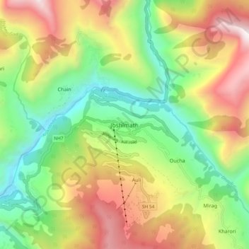
Name: Topografische Karte Joshīmath, Höhe, Relief.
Ort: Joshīmath, Joshimath Tehsil, Chamoli, Uttarakhand, Indien (30.51558 79.52126 30.59558 79.60126)
Durchschnittliche Höhe: 2.272 m
Minimale Höhe: 1.326 m
Maximale Höhe: 3.573 m
Andere topografische Karten
Klicken Sie auf eine Karte, um ihre Topografie, ihre Höhe und ihr Relief anzuzeigen.