
Topografische Karte Signal de Botrange
Interaktive Karte
Klicken Sie auf die Karte, um die Höhe anzuzeigen.
Signal de Botrange
Der auf der Botrange aufgeschüttete Baltia-Hügel (nach dem belgischen General-Leutnant und General-Gouverneur für die Ostkantone, Baron Herman Baltia benannt) wurde angelegt, um Belgiens höchsten Punkt auf 700 m Höhe zu bringen.
Über diese Karte
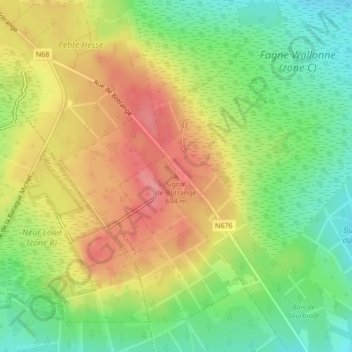
Name: Topografische Karte Signal de Botrange, Höhe, Relief.
Durchschnittliche Höhe: 658 m
Minimale Höhe: 616 m
Maximale Höhe: 701 m
Andere topografische Karten
Klicken Sie auf eine Karte, um ihre Topografie, ihre Höhe und ihr Relief anzuzeigen.