
Topografische Karte Rogersville
Interaktive Karte
Klicken Sie auf die Karte, um die Höhe anzuzeigen.
Rogersville
Rogersville is located slightly southwest of the center of Hawkins County. According to the United States Census Bureau, the town has a total area of 3.4 square miles (8.8 km2), all land. The town is in the valley of Crockett Creek, a southwest-flowing tributary of the Holston River. The elevation of Rogersville is 1,286 feet (392 m). Via U.S. Route 11W (see below), it is 28 miles (45 km) southwest of Kingsport and 65 miles (105 km) northeast of Knoxville.
Über diese Karte
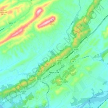
Name: Topografische Karte Rogersville, Höhe, Relief.
Durchschnittliche Höhe: 416 m
Minimale Höhe: 321 m
Maximale Höhe: 716 m
Andere topografische Karten
Klicken Sie auf eine Karte, um ihre Topografie, ihre Höhe und ihr Relief anzuzeigen.