Geolokalisieren

Topografische Karte Koya

Interaktive Karte

Klicken Sie auf die Karte, um die Höhe anzuzeigen.

Über diese Karte

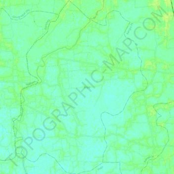
Name: Topografische Karte Koya, Höhe, Relief.

Ort: Koya, Kamrup, Assam, India (26.32521 91.51968 26.42098 91.60224)

Durchschnittliche Höhe: 50 m

Minimale Höhe: 45 m

Maximale Höhe: 56 m

Andere topografische Karten

Klicken Sie auf eine Karte, um ihre Topografie, ihre Höhe und ihr Relief anzuzeigen.

Digboi

India > Assam > Margherita

Durchschnittliche Höhe: 151 m

Balipara

India > Assam > Chariduar

Durchschnittliche Höhe: 80 m

Thesoajur

India > Assam > Diphu

Durchschnittliche Höhe: 208 m

Nikashi

India > Assam > Baska

Durchschnittliche Höhe: 99 m

Silchar

India > Assam > Silchar

Durchschnittliche Höhe: 32 m

Panitola

India > Assam > Tinsukia

Durchschnittliche Höhe: 119 m

Dhemaji

India > Assam > Dhemaji

Dhemaji is located at 27°29′N 94°35′E / 27.48°N 94.58°E / 27.48; 94.58. It has an average elevation of 91 metres (298 feet). Dhemaji is located to the north of the river Brahmaputra. To its north lies the Arunachal Himalayas. To its east lies the state, Arunachal Pradesh and to the west is…

Durchschnittliche Höhe: 102 m

Chhaygaon

India > Assam > Chhaygaon

Durchschnittliche Höhe: 50 m

Tezpur

India > Assam > Tezpur

Durchschnittliche Höhe: 68 m

Karimganj

India > Assam > Karimganj

Karimganj town is located at 24°52′N 92°21′E / 24.87°N 92.35°E / 24.87; 92.35. The area of Karimganj Town is 16.09 km2. It has an average elevation of 13 metres (42 feet).

Durchschnittliche Höhe: 18 m

Namrup

India > Assam > Naharkatiya

Durchschnittliche Höhe: 133 m

Kāmrūp

India > Assam

Durchschnittliche Höhe: 330 m

Nakhola

India > Assam > Mayong

Durchschnittliche Höhe: 103 m

Karbi Anglong

India > Assam

Durchschnittliche Höhe: 437 m

Guwahati

India > Assam > Guwahati

Professor Abani Kumar Bhagawati of Gauhati University stated that since before there were sufficient wetlands to absorb rainwater and channels to carry excess water to the Brahmaputra, the city did not experience floods. However, human interference has disrupted the natural topography, leading to the current…

Durchschnittliche Höhe: 113 m

VIP Area

India > Assam > Azara

Durchschnittliche Höhe: 51 m

Kopili

India > Assam > Sonapur

Durchschnittliche Höhe: 101 m

Udalguri

India > Assam > Udalguri tehsil

Odalguri is located at 26°44′43″N 92°05′46″E / 26.7452°N 92.0962°E / 26.7452; 92.0962. It has an average elevation of 180 metres (590 ft).

Durchschnittliche Höhe: 109 m

4 Kilo

India > Assam > Umrangso

Durchschnittliche Höhe: 623 m

Cāchār

India > Assam

Durchschnittliche Höhe: 476 m

Jorhat

India > Assam > Jorhat East

Jorhat is located at 26°45′N 94°13′E / 26.75°N 94.22°E / 26.75; 94.22. It has an average elevation of 116 metres (381 feet).

Durchschnittliche Höhe: 93 m

Kohora

India > Assam > Bokakhat

Durchschnittliche Höhe: 104 m

Maligaon

India > Assam > Guwahati > Maligaon

Durchschnittliche Höhe: 71 m

Umiam River

India > Assam > Donka

Durchschnittliche Höhe: 456 m

Lumding

India > Assam > Lanka > Lumding

Durchschnittliche Höhe: 159 m

Silghat

India > Assam > Kaliabor > Silghat

Durchschnittliche Höhe: 71 m

Sivasagar

India > Assam > Sibsagar

Sivasagar is located at 27°09′N 95°15′E / 27.15°N 95.25°E / 27.15; 95.25. It has an average elevation of 86.6 meters above sea level.

Durchschnittliche Höhe: 93 m

Bokajan

India > Assam > Diphu > Bokajan

Durchschnittliche Höhe: 142 m

Darrang

India > Assam

Durchschnittliche Höhe: 697 m

Manas National Park

India > Assam > Bijni (Pt)

Durchschnittliche Höhe: 276 m

Dispur

India > Assam > Dispur

Durchschnittliche Höhe: 78 m

Garamur

India > Assam > Garamur

Durchschnittliche Höhe: 84 m

Titabor

India > Assam > Titabor

Durchschnittliche Höhe: 97 m

Goalpara

India > Assam > Balijana

Durchschnittliche Höhe: 48 m

Pakke/Pakhui WLS/Tiger Reserve

India > Assam > Chariduar

Durchschnittliche Höhe: 636 m

Rongpharbi Rongbe;Diphu

India > Assam > Diphu > Rongpharbi Rongbe;Diphu

Diphu is located at 25°50′N 93°26′E / 25.83°N 93.43°E / 25.83; 93.43. It has an average elevation of 186 metres (610 feet). It is about 270 km by road and 213 km by railways from Guwahati. The town is located on a beautiful hill.

Durchschnittliche Höhe: 192 m