Geolokalisieren

Topografische Karte Camarines Norte

Interaktive Karte

Klicken Sie auf die Karte, um die Höhe anzuzeigen.

Über diese Karte

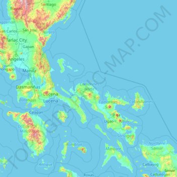
Name: Topografische Karte Camarines Norte, Höhe, Relief.

Ort: Camarines Norte, Bicol Region, Philippines (11.60667 120.19000 16.72667 125.31000)

Durchschnittliche Höhe: 80 m

Minimale Höhe: -2 m

Maximale Höhe: 2.758 m

Andere topografische Karten

Klicken Sie auf eine Karte, um ihre Topografie, ihre Höhe und ihr Relief anzuzeigen.

Bagasbas Beach

Philippines > Camarines Norte > Daet > Bagasbas

Durchschnittliche Höhe: 1 m

Daet

Philippines > Camarines Norte

Durchschnittliche Höhe: 6 m

Vinzons

Philippines > Camarines Norte

Durchschnittliche Höhe: 10 m

Tinaga Island

Philippines > Camarines Norte

Durchschnittliche Höhe: 5 m

Apuao Grande Island

Philippines > Camarines Norte

Durchschnittliche Höhe: 2 m

Caringo Island

Philippines > Camarines Norte

Durchschnittliche Höhe: 1 m

Canimog Island

Philippines > Camarines Norte

Durchschnittliche Höhe: 14 m

Malasugui Island

Philippines > Camarines Norte

Durchschnittliche Höhe: 0 m

Tailon Island

Philippines > Camarines Norte

Durchschnittliche Höhe: 0 m