
Topografische Karte Morley Bay
Interaktive Karte
Klicken Sie auf die Karte, um die Höhe anzuzeigen.
Über diese Karte
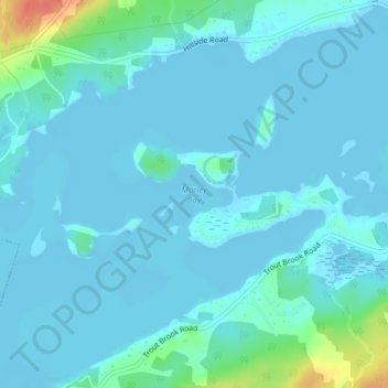
Name: Topografische Karte Morley Bay, Höhe, Relief.
Durchschnittliche Höhe: 6 m
Minimale Höhe: -2 m
Maximale Höhe: 49 m
Andere topografische Karten
Klicken Sie auf eine Karte, um ihre Topografie, ihre Höhe und ihr Relief anzuzeigen.
Sangaree Island
Canada > Nova Scotia > Cape Breton Regional Municipality > Albert Bridge
Sangaree Island, Albert Bridge, Cape Breton Regional Municipality, Cape Breton County, Nova Scotia, B1K 3H9, Canada
Durchschnittliche Höhe: 34 m