
Topografische Karte Tokyo
Interaktive Karte
Klicken Sie auf die Karte, um die Höhe anzuzeigen.
Über diese Karte
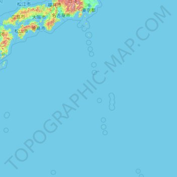
Name: Topografische Karte Tokyo, Höhe, Relief.
Ort: Tokyo, Japan (20.21458 135.85369 35.89842 154.20554)
Durchschnittliche Höhe: 22 m
Minimale Höhe: -3 m
Maximale Höhe: 3.459 m
The mainland portion of Tokyo lies northwest of Tokyo Bay and measures about 90 km (56 mi) east to west and 25 km (16 mi) north to south. The average elevation in Tokyo is 40 m (131 ft). Chiba Prefecture borders it to the east, Yamanashi to the west, Kanagawa to the south, and Saitama to the north. Mainland Tokyo is further subdivided into the special wards (occupying the eastern half) and the Tama area (多摩地域) stretching westwards. Tokyo has a latitude of 35.65 (near the 36th parallel north), which makes it more southern than Rome (41.90), Madrid (40.41), New York City (40.71) and Beijing (39.91).
Andere topografische Karten
Klicken Sie auf eine Karte, um ihre Topografie, ihre Höhe und ihr Relief anzuzeigen.
Ozora
Ozora, Abashiri County, Okhotsk Subprefecture, Hokkaido Prefecture, Japan
Durchschnittliche Höhe: 113 m
Biratori
Biratori, Saru County, Hidaka Subprefecture, Hokkaido Prefecture, Japan
Durchschnittliche Höhe: 185 m
Toshima Island
Toshima Island, Maizuru, Kyoto Prefecture, Japan
Durchschnittliche Höhe: 21 m
Niseko
Niseko, Abuta County, Shiribeshi Subprefecture, Hokkaido Prefecture, Japan
Durchschnittliche Höhe: 339 m
Nichinan
Nichinan, Hino County, Tottori Prefecture, Japan
Durchschnittliche Höhe: 581 m
Noto
Noto, Houshi County, Ishikawa Prefecture, Chubu Region, Japan
Durchschnittliche Höhe: 56 m
Kitanakagusuku
Kitanakagusuku, Nakagami, Okinawa Prefecture, Japan
Durchschnittliche Höhe: 59 m
Watarase Usuichi
Watarase Usuichi, Tochigi, Tochigi Prefecture, 374-0112, Japan
Durchschnittliche Höhe: 18 m
Minakami
Minakami, Tone County, Gunma Prefecture, Japan
Durchschnittliche Höhe: 1.021 m
Saza
Saza, Kita-Matsuura County, Nagasaki Prefecture, 857-0322, Japan
Durchschnittliche Höhe: 111 m
Arita
Arita, Nishi-Matsuura County, Saga Prefecture, Japan
Durchschnittliche Höhe: 184 m
Sagara
Sagara, Kuma County, Kumamoto Prefecture, 868-0094, Japan
Durchschnittliche Höhe: 422 m
Nakaniikawa County
Nakaniikawa County, Toyama Prefecture, Chubu Region, Japan
Durchschnittliche Höhe: 665 m
Hakone
Hakone, Ashigarashimo County, Kanagawa Prefecture, Japan
Durchschnittliche Höhe: 722 m
Ikaruga
Ikaruga, Ikoma County, Nara Prefecture, Japan
Durchschnittliche Höhe: 87 m
Furuu County
Furuu County, Shiribeshi Subprefecture, Hokkaido Prefecture, Japan
Durchschnittliche Höhe: 124 m
Ashigarashimo County
Ashigarashimo County, Kanagawa Prefecture, Japan
Durchschnittliche Höhe: 322 m
Manazuru
Manazuru, Ashigarashimo County, Kanagawa Prefecture, 259-0201, Japan
Durchschnittliche Höhe: 206 m