
Topografische Karte Oliktok Point
Interaktive Karte
Klicken Sie auf die Karte, um die Höhe anzuzeigen.
Über diese Karte
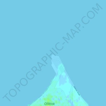
Name: Topografische Karte Oliktok Point, Höhe, Relief.
Ort: Oliktok Point, North Slope, Alaska, United States (70.51297 -149.87064 70.51307 -149.87054)
Durchschnittliche Höhe: 0 m
Minimale Höhe: -2 m
Maximale Höhe: 7 m
Andere topografische Karten
Klicken Sie auf eine Karte, um ihre Topografie, ihre Höhe und ihr Relief anzuzeigen.
Footprint Lake
United States > Alaska > North Slope > Utqiaġvik
Footprint Lake, Utqiaġvik, North Slope, Alaska, United States
Durchschnittliche Höhe: 8 m
Point Barrow
United States > Alaska > North Slope
Point Barrow, North Slope, Alaska, United States
Durchschnittliche Höhe: 0 m
Thunder Creek
United States > Alaska > North Slope
Thunder Creek, North Slope, Alaska, United States
Durchschnittliche Höhe: 731 m
Wainwright
United States > Alaska > North Slope > Wainwright
Wainwright, North Slope, Alaska, 99782, United States
Durchschnittliche Höhe: 3 m
Howe Island
United States > Alaska > North Slope
Howe Island, North Slope, Alaska, United States
Durchschnittliche Höhe: 0 m