
Topografische Karte Kanyakumari
Klicken Sie auf die Karte, um die Höhe anzuzeigen.
Kanyakumari
Kanniyakumari is located at 8°05′N 77°34′E / 8.08°N 77.57°E / 8.08; 77.57 and has an average elevation of 30 metres. The peninsular tip of Kanniyakumari is bordered on three sides by the Laccadive Sea. It is located at the confluence of the Western Coastal Plains and Eastern Coastal Plains. The nearest city is Thiruvananthapuram, Kerala (85 km (53 mi) away), and the nearest town is Nagercoil, the administrative headquarters of Kanniyakumari district (22 km (14 mi) away).
Über diese Karte
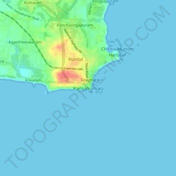
Name: Topografische Karte Kanyakumari, Höhe, Relief.
Durchschnittliche Höhe: 6 m
Minimale Höhe: 0 m
Maximale Höhe: 55 m