
Topografische Karte Perímetro Urbano Neiva
Interaktive Karte
Klicken Sie auf die Karte, um die Höhe anzuzeigen.
Perímetro Urbano Neiva
Due to its location near the equator and its low altitude, the city has a hot annual average climate with daytime temperatures ranging from 88 to 95 degrees Fahrenheit. It is about 300 kilometers / 186.4 miles (about a five-hour drive) from the Colombian capital, Bogotá.
Über diese Karte
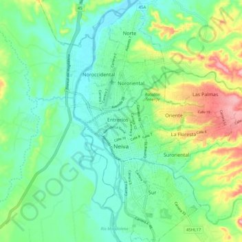
Name: Topografische Karte Perímetro Urbano Neiva, Höhe, Relief.
Durchschnittliche Höhe: 469 m
Minimale Höhe: 419 m
Maximale Höhe: 588 m
Andere topografische Karten
Klicken Sie auf eine Karte, um ihre Topografie, ihre Höhe und ihr Relief anzuzeigen.