
Topografische Karte Karimpur
Klicken Sie auf die Karte, um die Höhe anzuzeigen.
Karimpur
Karimpur is located at 23°58′N 88°37′E / 23.97°N 88.62°E / 23.97; 88.62. It has an average elevation of 15 metres (49 ft). It is 183 km (114 mi) from Kolkata and is located at the bank of the River Jalangi.
Über diese Karte
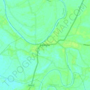
Name: Topografische Karte Karimpur, Höhe, Relief.
Ort: Karimpur, Karimpur-I, Nadia, West Bengal, 741152, India (23.94160 88.58961 24.02160 88.66961)
Durchschnittliche Höhe: 18 m
Minimale Höhe: 13 m
Maximale Höhe: 24 m