
Topografische Karte Cairo
Interaktive Karte
Klicken Sie auf die Karte, um die Höhe anzuzeigen.
Über diese Karte
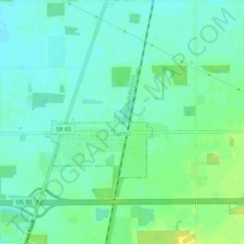
Name: Topografische Karte Cairo, Höhe, Relief.
Ort: Cairo, Allen County, Ohio, 45820, United States (40.82698 -84.09318 40.83927 -84.07743)
Durchschnittliche Höhe: 249 m
Minimale Höhe: 241 m
Maximale Höhe: 261 m
The elevation of the land area of Cairo (ranges from about 812' at the west end to 842' at the east end of the village above sea level) is benchmarked at 815 feet (248 m) above sea level, generally flat and moderately wooded. The nearest stream with year-round flow is Rattlesnake Creek, which flows from south of the village and passes just to the west of the village. Water flow in the village is generally from the south and east to the north and west.
Andere topografische Karten
Klicken Sie auf eine Karte, um ihre Topografie, ihre Höhe und ihr Relief anzuzeigen.
Lima
United States > Ohio > Allen County
Lima, Allen County, Ohio, 45804, United States
Durchschnittliche Höhe: 267 m
Spencerville
United States > Ohio > Allen County
Spencerville, Allen County, Ohio, 45887, United States
Durchschnittliche Höhe: 254 m
Bluffton
United States > Ohio > Allen County
Bluffton, Allen County, Ohio, 45817, United States
Durchschnittliche Höhe: 255 m
Maysville
United States > Ohio > Allen County
Maysville, Jackson Township, Allen County, Ohio, United States
Durchschnittliche Höhe: 307 m
Kemp
United States > Ohio > Allen County
Kemp, Allen County, Ohio, United States
Durchschnittliche Höhe: 256 m
Landeck
United States > Ohio > Allen County
Landeck, Allen County, Ohio, United States
Durchschnittliche Höhe: 242 m
Scotts Crossing
United States > Ohio > Allen County
Scotts Crossing, Allen County, Ohio, United States
Durchschnittliche Höhe: 239 m
Hume
United States > Ohio > Allen County
Hume, Allen County, Ohio, United States
Durchschnittliche Höhe: 260 m
Gomer
United States > Ohio > Allen County
Gomer, Allen County, Ohio, 45809, United States
Durchschnittliche Höhe: 237 m
West Newton
United States > Ohio > Allen County
West Newton, Auglaize Township, Allen County, Ohio, United States
Durchschnittliche Höhe: 316 m
Southworth
United States > Ohio > Allen County
Southworth, Allen County, Ohio, United States
Durchschnittliche Höhe: 247 m
South Warsaw
United States > Ohio > Allen County
South Warsaw, Perry Township, Allen County, Ohio, United States
Durchschnittliche Höhe: 283 m
Rockport
United States > Ohio > Allen County
Rockport, Monroe Township, Allen County, Ohio, 45830, United States
Durchschnittliche Höhe: 248 m
Conant
United States > Ohio > Allen County
Conant, Allen County, Ohio, United States
Durchschnittliche Höhe: 251 m
Allentown
United States > Ohio > Allen County > Lima
Allentown, Lima, Allen County, Ohio, 45805, United States
Durchschnittliche Höhe: 250 m
Westminster
United States > Ohio > Allen County
Westminster, Auglaize Township, Allen County, Ohio, United States
Durchschnittliche Höhe: 294 m
Delphos
United States > Ohio > Allen County
Delphos, Allen County, Ohio, 45833, United States
Durchschnittliche Höhe: 236 m
Elida
United States > Ohio > Allen County
Elida, Allen County, Ohio, United States
Durchschnittliche Höhe: 244 m
Beaverdam
United States > Ohio > Allen County
Beaverdam, Allen County, Ohio, 45808, United States
Durchschnittliche Höhe: 264 m
Fort Shawnee
United States > Ohio > Allen County
Fort Shawnee, Allen County, Ohio, 45806, United States
Durchschnittliche Höhe: 268 m
Lafayette
United States > Ohio > Allen County
Lafayette, Allen County, Ohio, 45854, United States
Durchschnittliche Höhe: 286 m
Lima
United States > Ohio > Allen County
Lima, Allen County, Ohio, 45804, United States
Durchschnittliche Höhe: 267 m
Harrod
United States > Ohio > Allen County
Harrod, Allen County, Ohio, United States
Durchschnittliche Höhe: 305 m