
Topografische Karte Tarkastad
Interaktive Karte
Klicken Sie auf die Karte, um die Höhe anzuzeigen.
Über diese Karte
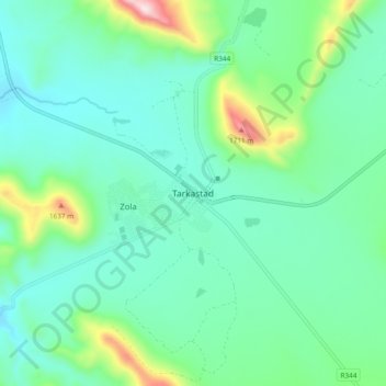
Name: Topografische Karte Tarkastad, Höhe, Relief.
Durchschnittliche Höhe: 1.347 m
Minimale Höhe: 1.228 m
Maximale Höhe: 1.777 m
Scientists have stated that Tarkastad has one of the healthiest climates in the world. Winters are cold with frequent snowfalls on high lying mountain tops, while summers are hot and dry. Tarkastad which is situated at an elevation of 1,304 metres normally receives about 335mm of rain per year, with most rainfall occurring mainly during summer.
Andere topografische Karten
Klicken Sie auf eine Karte, um ihre Topografie, ihre Höhe und ihr Relief anzuzeigen.
Elandskop
South Africa > Eastern Cape > Chris Hani District Municipality > Tsolwana Local Municipality
Elandskop, Tsolwana Local Municipality, Chris Hani District Municipality, Eastern Cape, South Africa
Durchschnittliche Höhe: 1.386 m