
Topografische Karte Waterton Park
Interaktive Karte
Klicken Sie auf die Karte, um die Höhe anzuzeigen.
Über diese Karte
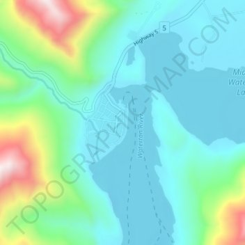
Name: Topografische Karte Waterton Park, Höhe, Relief.
Durchschnittliche Höhe: 1.456 m
Minimale Höhe: 1.269 m
Maximale Höhe: 2.207 m
It is located at the southwestern terminus of Highway 5, approximately 54 kilometres (34 mi) west of the Town of Cardston and 55 kilometres (34 mi) south of the Town of Pincher Creek. This hamlet is north of Glacier National Park in Montana. It has an elevation of 1,280 metres (4,200 ft).