
Topografische Karte Uson
Interaktive Karte
Klicken Sie auf die Karte, um die Höhe anzuzeigen.
Über diese Karte
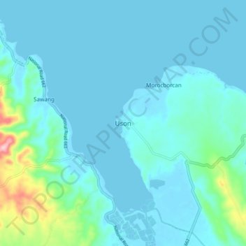
Name: Topografische Karte Uson, Höhe, Relief.
Ort: Uson, Bangad, Masbate, Bicol Region, Philippines (12.18530 123.74340 12.26530 123.82340)
Durchschnittliche Höhe: 25 m
Minimale Höhe: -2 m
Maximale Höhe: 205 m
With and elevation of 604 metres (1,982 ft) above sea level, Mount Uac is the highest point of the municipality. The mountain borders the three municipalities of Uson, Mobo and Milagros.