
Topografische Karte Pellegrini Lake
Interaktive Karte
Klicken Sie auf die Karte, um die Höhe anzuzeigen.
Über diese Karte
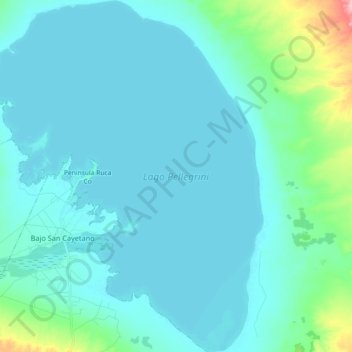
Name: Topografische Karte Pellegrini Lake, Höhe, Relief.
Durchschnittliche Höhe: 287 m
Minimale Höhe: 270 m
Maximale Höhe: 414 m
After the first years of operation of the dam Dique Ing. Ballester, in 1936, the lake that was formed already registered a water level of 267,60 m. Up to this date, that level has small variations around the 272 m elevation.