
Topografische Karte Peachtree City
Interaktive Karte
Klicken Sie auf die Karte, um die Höhe anzuzeigen.
Über diese Karte
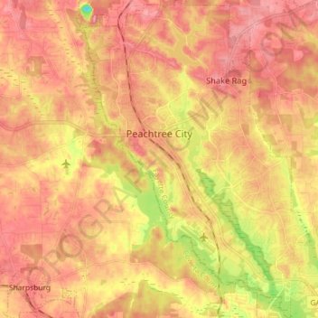
Name: Topografische Karte Peachtree City, Höhe, Relief.
Durchschnittliche Höhe: 263 m
Minimale Höhe: 181 m
Maximale Höhe: 310 m
Shakerag Hill, with an elevation of 980 feet (300 m), is the highest point in the city and sits on the eastern border at the intersection of GA Hwy 54 and Robinson Road.