
Topografische Karte Joseph
Interaktive Karte
Klicken Sie auf die Karte, um die Höhe anzuzeigen.
Joseph
According to the United States Census Bureau, the city has a total area of 0.88 square miles (2.28 km2), all of it land. The elevation is 4,190 feet (1,280 m) above sea level.
Über diese Karte
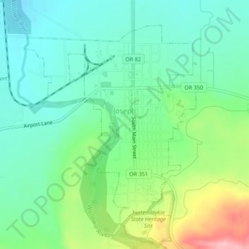
Name: Topografische Karte Joseph, Höhe, Relief.
Ort: Joseph, Wallowa County, Oregon, 97846, United States (45.33959 -117.24665 45.36118 -117.22024)
Durchschnittliche Höhe: 1.285 m
Minimale Höhe: 1.235 m
Maximale Höhe: 1.404 m
Andere topografische Karten
Klicken Sie auf eine Karte, um ihre Topografie, ihre Höhe und ihr Relief anzuzeigen.