
Topografische Karte Anapa
Interaktive Karte
Klicken Sie auf die Karte, um die Höhe anzuzeigen.
Anapa
Anapa has a humid subtropical climate (Köppen climate classification Cfa) with mediterranean (Csa) influences at the lower elevations. Compared to cities further south along the coast like Novorossiysk and Sochi, Anapa receives considerably less rainfall but has somewhat colder winters.
Über diese Karte
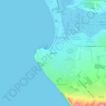
Name: Topografische Karte Anapa, Höhe, Relief.
Durchschnittliche Höhe: 16 m
Minimale Höhe: -3 m
Maximale Höhe: 188 m