
Topografische Karte Santa Mesa
Interaktive Karte
Klicken Sie auf die Karte, um die Höhe anzuzeigen.
Santa Mesa
The topography of the area is relatively flat as some of the natural variations in elevations have been evened out due to urbanization.
Über diese Karte
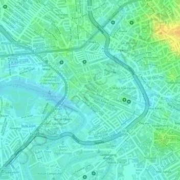
Name: Topografische Karte Santa Mesa, Höhe, Relief.
Durchschnittliche Höhe: 9 m
Minimale Höhe: 0 m
Maximale Höhe: 30 m