
Topografische Karte Rainier
Interaktive Karte
Klicken Sie auf die Karte, um die Höhe anzuzeigen.
Über diese Karte
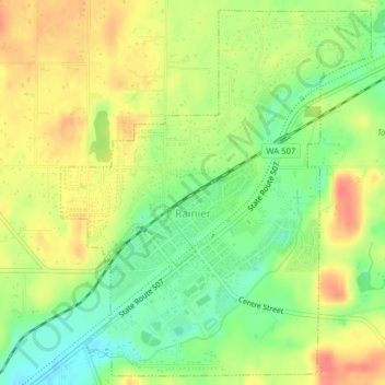
Name: Topografische Karte Rainier, Höhe, Relief.
Ort: Rainier, Thurston County, Washington, 98576, United States (46.87966 -122.70292 46.90530 -122.67109)
Durchschnittliche Höhe: 143 m
Minimale Höhe: 113 m
Maximale Höhe: 173 m
Andere topografische Karten
Klicken Sie auf eine Karte, um ihre Topografie, ihre Höhe und ihr Relief anzuzeigen.
Vail
United States > Washington > Thurston County
Vail, Thurston County, Washington, United States
Durchschnittliche Höhe: 183 m
Lacey
United States > Washington > Thurston County
Lacey, Thurston County, Washington, United States
Durchschnittliche Höhe: 47 m
Olympia
United States > Washington > Thurston County
Olympia, Thurston County, Washington, United States
Durchschnittliche Höhe: 49 m