
Topografische Karte Sabin
Interaktive Karte
Klicken Sie auf die Karte, um die Höhe anzuzeigen.
Über diese Karte
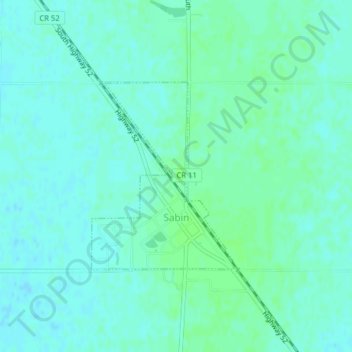
Name: Topografische Karte Sabin, Höhe, Relief.
Ort: Sabin, Clay County, Minnesota, United States (46.77563 -96.66266 46.79006 -96.64677)
Durchschnittliche Höhe: 282 m
Minimale Höhe: 278 m
Maximale Höhe: 285 m
Sabin is mostly south under U.S. Route 52 and the shortline railway owned by Otter Tail Valley Railroad Company that runs parallel to Route 52. According to the United States Census Bureau, the city of Sabin has an area of 0.35 square miles (0.91 km2), all land. The elevation is approximately 929 feet.
Andere topografische Karten
Klicken Sie auf eine Karte, um ihre Topografie, ihre Höhe und ihr Relief anzuzeigen.
Dilworth
United States > Minnesota > Clay County
Dilworth, Clay County, Minnesota, 56529, United States
Durchschnittliche Höhe: 278 m
Comstock
United States > Minnesota > Clay County
Comstock, Clay County, Minnesota, 56525, United States
Durchschnittliche Höhe: 281 m
Hitterdal
United States > Minnesota > Clay County
Hitterdal, Clay County, Minnesota, United States
Durchschnittliche Höhe: 379 m
Georgetown
United States > Minnesota > Clay County
Georgetown, Clay County, Minnesota, United States
Durchschnittliche Höhe: 269 m
Baker
United States > Minnesota > Clay County
Baker, Clay County, Minnesota, United States
Durchschnittliche Höhe: 286 m
Hitterdahl WMA
United States > Minnesota > Clay County
Hitterdahl WMA, 270th Street North, Clay County, Minnesota, 56552, United States
Durchschnittliche Höhe: 379 m
Glyndon
United States > Minnesota > Clay County
Glyndon, Clay County, Minnesota, 56547, United States
Durchschnittliche Höhe: 282 m
Moorhead
United States > Minnesota > Clay County
Moorhead, Clay County, Minnesota, United States
Durchschnittliche Höhe: 277 m
Kragnes
United States > Minnesota > Clay County
Kragnes, Clay County, Minnesota, United States
Durchschnittliche Höhe: 273 m
Ulen
United States > Minnesota > Clay County
Ulen, Clay County, Minnesota, 56585, United States
Durchschnittliche Höhe: 352 m
Moorhead
United States > Minnesota > Clay County > Moorhead > Moorhead
Moorhead, Clay County, Minnesota, 56563, United States
Durchschnittliche Höhe: 277 m
confluence of Red River of the North and Buffalo River
United States > Minnesota > Clay County
confluence of Red River of the North and Buffalo River, Wiser Township, Clay County, Minnesota, United States
Durchschnittliche Höhe: 268 m
Barnesville
United States > Minnesota > Clay County
Barnesville, Clay County, Minnesota, 56514, United States
Durchschnittliche Höhe: 311 m
Felton
United States > Minnesota > Clay County
Felton, Clay County, Minnesota, United States
Durchschnittliche Höhe: 279 m
Hawley
United States > Minnesota > Clay County
Hawley, Clay County, Minnesota, United States
Durchschnittliche Höhe: 356 m