
Topografische Karte Johnson County
Interaktive Karte
Klicken Sie auf die Karte, um die Höhe anzuzeigen.
Über diese Karte
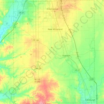
Name: Topografische Karte Johnson County, Höhe, Relief.
Ort: Johnson County, Indiana, United States (39.34202 -86.25141 39.63850 -85.95087)
Durchschnittliche Höhe: 232 m
Minimale Höhe: 189 m
Maximale Höhe: 310 m
Andere topografische Karten
Klicken Sie auf eine Karte, um ihre Topografie, ihre Höhe und ihr Relief anzuzeigen.
Banta
United States > Indiana > Johnson County > Bargersville
Banta, Bargersville, Johnson County, Indiana, United States
Durchschnittliche Höhe: 232 m
Greenwood
United States > Indiana > Johnson County
Greenwood, Johnson County, Indiana, United States
Durchschnittliche Höhe: 245 m