
Topografische Karte Mount Zion
Interaktive Karte
Klicken Sie auf die Karte, um die Höhe anzuzeigen.
Über diese Karte
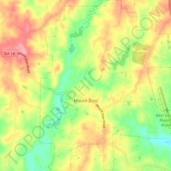
Name: Topografische Karte Mount Zion, Höhe, Relief.
Ort: Mount Zion, Carroll County, Georgia, United States (33.60884 -85.20707 33.67039 -85.14784)
Durchschnittliche Höhe: 356 m
Minimale Höhe: 307 m
Maximale Höhe: 404 m
Andere topografische Karten
Klicken Sie auf eine Karte, um ihre Topografie, ihre Höhe und ihr Relief anzuzeigen.
Carrollton
United States > Georgia > Carroll County
Carrollton, Carroll County, Georgia, United States
Durchschnittliche Höhe: 329 m
Villa Rica
United States > Georgia > Carroll County
Villa Rica, Carroll County, Georgia, 30180, United States
Durchschnittliche Höhe: 338 m
Bowdon
United States > Georgia > Carroll County
Bowdon, Carroll County, Georgia, 30108, United States
Durchschnittliche Höhe: 319 m