
Topografische Karte Inks Lake State Park
Interaktive Karte
Klicken Sie auf die Karte, um die Höhe anzuzeigen.
Über diese Karte
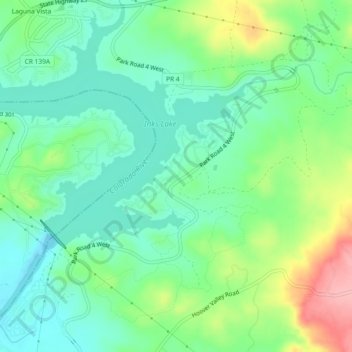
Name: Topografische Karte Inks Lake State Park, Höhe, Relief.
Durchschnittliche Höhe: 294 m
Minimale Höhe: 253 m
Maximale Höhe: 383 m
Conservation Pool Elevation usually stays around 888.22 ft. msl; however, this lake does fluctuate about 1 foot annually. Inks lake water clarity can be seen as clear to slightly stained mostly throughout the year. It tends to have higher turbidity during the rainy season due to excessive amounts of runoff.