
Topografische Karte Vijayawada
Klicken Sie auf die Karte, um die Höhe anzuzeigen.
Vijayawada
Vijayawada lies on the banks of Krishna river, covered by hills and canals. and at an altitude of 11 m (36 ft) above sea level. Three canals originating from the north side of the Prakasam Barrage reservoir — Eluru, Bandar, and Ryves — flow through the city.
Über diese Karte
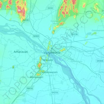
Name: Topografische Karte Vijayawada, Höhe, Relief.
Durchschnittliche Höhe: 37 m
Minimale Höhe: 7 m
Maximale Höhe: 448 m