
Topografische Karte Nicksville
Interaktive Karte
Klicken Sie auf die Karte, um die Höhe anzuzeigen.
Über diese Karte
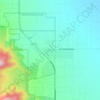
Name: Topografische Karte Nicksville, Höhe, Relief.
Durchschnittliche Höhe: 1.483 m
Minimale Höhe: 1.387 m
Maximale Höhe: 1.824 m
Nicksville is a populated place in Cochise County, Arizona, just north of the international border between the United States and Mexico. It has an estimated elevation of 4,816 feet (1,468 m) above sea level.