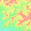
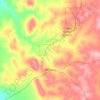
Topografische Karte Mount Meharry
Klicken Sie auf die Karte, um die Höhe anzuzeigen.
Mount Meharry
The summit of Mount Meharry can be reached from the Great Northern Highway via an unsealed road 16 kilometres (9.9 mi) in length and a vehicular track 21 kilometres (13 mi) in length. Permission should be sought from the managers of the land over which the road and track pass. These are Juna Downs Station and the Department of Parks and Wildlife, which manages Karijini National Park. In dry conditions, a two-wheel-drive vehicle can reach the national park boundary at about 800 metres (2,600 ft) elevation, requiring a walk of about 7 kilometres (4.3 mi) to the summit.
Über diese Karte

Name: Topografische Karte Mount Meharry, Höhe, Relief.
Durchschnittliche Höhe: 1.030 m
Minimale Höhe: 859 m
Maximale Höhe: 1.247 m
Andere topografische Karten
Klicken Sie auf eine Karte, um ihre Topografie, ihre Höhe und ihr Relief anzuzeigen.








Stirling Range National Park
The park is particularly rich in banksias, eucalypts, orchids and verticordias. Ten species of mountain bells (Darwinia spp.) have been identified in the park and only one of these is found outside Stirling Range. Five major vegetation communities are known in the park with thicket and mallee-heath at higher…
Durchschnittliche Höhe: 235 m














Wolfe Creek Meteorite Crater National Park
Durchschnittliche Höhe: 349 m