Geolokalisieren

Topografische Karte Kieler

Klicken Sie auf die Karte, um die Höhe anzuzeigen.

Über diese Karte

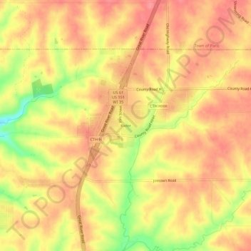
Name: Topografische Karte Kieler, Höhe, Relief.

Ort: Kieler, Town of Jamestown, Grant County, Wisconsin, 53812, United States (42.56231 -90.62184 42.60231 -90.58184)

Durchschnittliche Höhe: 275 m

Minimale Höhe: 221 m

Maximale Höhe: 300 m

Andere topografische Karten

Klicken Sie auf eine Karte, um ihre Topografie, ihre Höhe und ihr Relief anzuzeigen.

Mississippi River

United States > Wisconsin > Grant County > Dubuque

The uppermost lock and dam on the Upper Mississippi River is the Upper St. Anthony Falls Lock and Dam in Minneapolis. Above the dam, the river's elevation is 799 feet (244 m). Below the dam, the river's elevation is 750 feet (230 m). This 49-foot (15 m) drop is the largest of all the Mississippi River locks…

Durchschnittliche Höhe: 203 m

Fennimore

United States > Wisconsin > Grant County

Durchschnittliche Höhe: 353 m

Town of Beetown

United States > Wisconsin > Grant County

Durchschnittliche Höhe: 281 m

Village of Woodman

United States > Wisconsin > Grant County

Durchschnittliche Höhe: 236 m

Tennyson

United States > Wisconsin > Grant County

Durchschnittliche Höhe: 282 m

Mount Hope

United States > Wisconsin > Grant County

Durchschnittliche Höhe: 349 m

Patch Grove

United States > Wisconsin > Grant County

Durchschnittliche Höhe: 336 m

Potosi

United States > Wisconsin > Grant County

Durchschnittliche Höhe: 264 m

Montfort

United States > Wisconsin > Grant County

Durchschnittliche Höhe: 348 m

Cuba City

United States > Wisconsin > Grant County

Durchschnittliche Höhe: 301 m

Bagley

United States > Wisconsin > Grant County

Durchschnittliche Höhe: 207 m

Bloomington

United States > Wisconsin > Grant County

Durchschnittliche Höhe: 300 m

Hazel Green

United States > Wisconsin > Grant County

Durchschnittliche Höhe: 278 m

Dickeyville

United States > Wisconsin > Grant County

Durchschnittliche Höhe: 275 m

Town of Paris

United States > Wisconsin > Grant County

Durchschnittliche Höhe: 252 m

Blue River

United States > Wisconsin > Grant County

Durchschnittliche Höhe: 223 m

Town of Wyalusing

United States > Wisconsin > Grant County

Durchschnittliche Höhe: 264 m

Livingston

United States > Wisconsin > Grant County

Durchschnittliche Höhe: 345 m

Rüste dich für dein nächstes Abenteuer:

🥾Wanderschuhe für Damen - Leichte und stabile Wanderschuhe für Berg- und Naturwanderungen
Outdoor Uhren - Funktionale Uhren für Abenteuer
🌍Straßenatlas Österreich - Großformatige Übersicht für die Anreise in die Bergregionen
🌊Mobiler Wasserfilter - Sicheres Trinkwasser aus Bächen und Seen gewinnen
😴Selbstaufblasende Isomatte - Schutz vor Bodenkälte und unebenem Untergrund

Als Amazon-Partner verdient diese Website an qualifizierten Käufen, ohne zusätzliche Kosten für Sie.