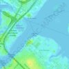
Topografische Karte Brooklyn
Klicken Sie auf die Karte, um die Höhe anzuzeigen.
Brooklyn
Brooklyn’s topography is shaped by its position on western Long Island, where low coastal plains, harbor margins, and glacial landforms meet in a densely urbanized landscape. Much of southern and eastern Brooklyn forms a gently sloping outwash plain that descends toward Jamaica Bay, Coney Island, Gravesend Bay, and the Atlantic-facing shore, while the central and northwestern parts rise into a modest but distinct belt of hills associated with the terminal moraine that runs through Brooklyn and Queens. This moraine gives areas around Prospect Park, Park Slope, Sunset Park, and Green-Wood Cemetery a more rolling physical character, with short ridges, knolls, and locally sharper relief compared with the flatter coastal neighborhoods. Green-Wood’s Battle Hill is widely identified as Brooklyn’s highest natural point, standing a little over 200 ft above sea level, and it illustrates how the borough’s most pronounced elevations are glacial rather than bedrock mountain forms. Overall, Brooklyn presents a subdued but varied urban terrain: low tidal edges and reclaimed waterfronts around the harbor, broad sandy plains toward the south, and a central moraine ridge that provides the borough’s main elevation contrast and long views across New York Harbor.
Über diese Karte

Name: Topografische Karte Brooklyn, Höhe, Relief.
Ort: Brooklyn, Kings County, New York, United States (40.55034 -74.05669 40.73943 -73.83295)
Durchschnittliche Höhe: 9 m
Minimale Höhe: -10 m
Maximale Höhe: 62 m
Andere topografische Karten
Klicken Sie auf eine Karte, um ihre Topografie, ihre Höhe und ihr Relief anzuzeigen.
Central Park
United States > New York > New York
In June 1856, Fernando Wood appointed a "consulting board" of seven people, headed by author Washington Irving, to inspire public confidence in the proposed development. Wood hired military engineer Egbert Ludovicus Viele as the park's chief engineer, tasking him with a topographical survey of the site. The…
Durchschnittliche Höhe: 26 m
Central Park
United States > New York > New York
In June 1856, Fernando Wood appointed a "consulting board" of seven people, headed by author Washington Irving, to inspire public confidence in the proposed development. Wood hired military engineer Egbert Ludovicus Viele as the park's chief engineer, tasking him with a topographical survey of the site. The…
Durchschnittliche Höhe: 26 m

Snug Harbor Cultural Center and Botanical Garden
United States > New York > New York
Building C, also known as the Administration Building, was completed in 1833 and is Lafever's oldest surviving work. As of 2020, building C houses part of the Newhouse Center for Contemporary Art. The building consists of two stories, a raised basement, and an attic; it is rectangular in plan with a gable…
Durchschnittliche Höhe: 20 m


Flushing Meadows-Corona Park
United States > New York > New York
Around 1907, contractor Michael Degnon, whose firm constructed the Williamsburg Bridge, the Cape Cod Canal, and the Steinway subway tunnel (used by today's 7 and <7> trains), purchased large tracts of marsh near Flushing Creek. At the time, the land was considered "all but worthless". Degnon envisioned…
Durchschnittliche Höhe: 15 m
Snug Harbor Cultural Center and Botanical Garden
United States > New York > New York
Building C, also known as the Administration Building, was completed in 1833 and is Lafever's oldest surviving work. It houses part of the Newhouse Center for Contemporary Art. The building consists of two stories, a raised basement, and an attic; it is rectangular in plan with a gable roof. The main entrance…
Durchschnittliche Höhe: 20 m