
Topografische Karte Breckenridge
Interaktive Karte
Klicken Sie auf die Karte, um die Höhe anzuzeigen.
Über diese Karte
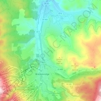
Name: Topografische Karte Breckenridge, Höhe, Relief.
Durchschnittliche Höhe: 3.072 m
Minimale Höhe: 2.802 m
Maximale Höhe: 3.809 m
At the 2020 United States Census, the town had a total area of 6.047 square miles (15.661 km2), all of it land. The ski area has a total area of 2,880 acres (11.7 km2) of land. The elevation of Breckenridge is 9,600 feet (2,900 m) above sea level.