
Spenden
Rüste dich für dein nächstes Abenteuer:
Als Amazon-Partner verdient diese Website an qualifizierten Käufen, ohne zusätzliche Kosten für Sie.
Topografische Karte Thousand Springs
Klicken Sie auf die Karte, um die Höhe anzuzeigen.
Spenden
Rüste dich für dein nächstes Abenteuer:
Als Amazon-Partner verdient diese Website an qualifizierten Käufen, ohne zusätzliche Kosten für Sie.
Über diese Karte
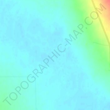
Name: Topografische Karte Thousand Springs, Höhe, Relief.
Ort: Thousand Springs, Custer County, Idaho, United States (44.13709 -113.92342 44.13719 -113.92332)
Durchschnittliche Höhe: 1.922 m
Minimale Höhe: 1.914 m
Maximale Höhe: 1.964 m
Spenden
Rüste dich für dein nächstes Abenteuer:
Als Amazon-Partner verdient diese Website an qualifizierten Käufen, ohne zusätzliche Kosten für Sie.
Andere topografische Karten
Klicken Sie auf eine Karte, um ihre Topografie, ihre Höhe und ihr Relief anzuzeigen.
Clayton
United States > Idaho > Custer County
Clayton is located at 44°15′32″N 114°23′59″W / 44.25889°N 114.39972°W / 44.25889; -114.39972 (44.259014, -114.399725), at an elevation of 5,489 feet (1,673 m) above sea level.
Durchschnittliche Höhe: 1.965 m
Stanley Lake
United States > Idaho > Custer County
The lake is approximately seven miles (11 km) west of Stanley, readily accessed via a three-mile (5 km) spur road from State Highway 21. The surface elevation of the lake is 6,513 feet (1,985 m) above sea level.
Durchschnittliche Höhe: 2.075 m