

Topografische Karte Johnson City
Klicken Sie auf die Karte, um die Höhe anzuzeigen.
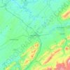
Johnson City
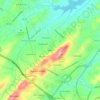
Johnson City occupies a broad Appalachian valley in northeastern Tennessee, where the smoother urban floor around Sinking Creek and Brush Creek sits at roughly 1,600 feet (488 meters) above sea level and is framed by progressively higher, more rugged terrain. The landscape reflects the Ridge-and-Valley character of East Tennessee, with long northeast–southwest ridges, eroded valleys, and folded sedimentary rocks shaping the local relief. To the south, the terrain rises sharply toward Buffalo Mountain, Cherokee Mountain, and the forested highlands of the Cherokee National Forest, creating a strong contrast between the gently rolling city basin and the steeper, dissected slopes beyond. Overall, the area has a distinctly Southern Appalachian physical character: settled lowlands, narrow stream corridors, wooded ridges, and nearby mountain crests that give Johnson City a sheltered yet visibly mountainous setting.
Über diese Karte
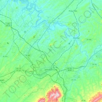
Name: Topografische Karte Johnson City, Höhe, Relief.
Durchschnittliche Höhe: 513 m
Minimale Höhe: 399 m
Maximale Höhe: 975 m
Andere topografische Karten
Klicken Sie auf eine Karte, um ihre Topografie, ihre Höhe und ihr Relief anzuzeigen.
Boones Creek
United States > Tennessee > Washington County > Johnson City
Durchschnittliche Höhe: 461 m




Buckstone Hills
United States > Tennessee > Washington County > Johnson City
Durchschnittliche Höhe: 553 m

McKinley
United States > Tennessee > Washington County > Johnson City > Midway
Durchschnittliche Höhe: 540 m
Johnson City
United States > Tennessee > Washington County > Johnson City
Durchschnittliche Höhe: 583 m


Greenfield Heights
United States > Tennessee > Washington County > Johnson City
Durchschnittliche Höhe: 499 m

Montcastle Hills
United States > Tennessee > Washington County > Johnson City
Durchschnittliche Höhe: 506 m
Dogwood Acres
United States > Tennessee > Washington County > Johnson City
Durchschnittliche Höhe: 550 m
East Ridge
United States > Tennessee > Washington County > Johnson City > East Ridge
Durchschnittliche Höhe: 509 m