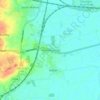
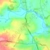
Topografische Karte Malham
Klicken Sie auf die Karte, um die Höhe anzuzeigen.
Malham
Malham has an Oceanic climate, but is generally colder and wetter than most settlements in Britain. It has a relatively low altitude of around 200 metres, but is partly surrounded by fells. This exposed position means the temperature range is limited, due to little pooling of cold air. Extremes of temperature (since 1960) range from 28.2 °C (82.8 °F) during August 1990, down to −13.5 °C (7.7 °F) during March 2001.
Über diese Karte

Name: Topografische Karte Malham, Höhe, Relief.
Durchschnittliche Höhe: 362 m
Minimale Höhe: 178 m
Maximale Höhe: 545 m
Andere topografische Karten
Klicken Sie auf eine Karte, um ihre Topografie, ihre Höhe und ihr Relief anzuzeigen.
Scarborough
United Kingdom > England > North Yorkshire
The climate is temperate with mild summers and cool, windy, winters. The hottest months of the year are July and August, with temperatures reaching an average high of 17 °C and falling to 11 °C at night. The average daytime temperatures in January are 4 °C, falling to 1 °C at night. The station's elevation…
Durchschnittliche Höhe: 39 m

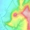
Roseberry Topping
United Kingdom > England > North Yorkshire > Great Ayton
Durchschnittliche Höhe: 172 m









Levisham Moor
United Kingdom > England > North Yorkshire > Newton upon Rawcliffe
Durchschnittliche Höhe: 188 m

Cod Beck
United Kingdom > England > North Yorkshire > Osmotherley > Clack
Durchschnittliche Höhe: 156 m












Bolton Castle
United Kingdom > England > North Yorkshire > Redmire > Castle Bolton
Durchschnittliche Höhe: 250 m


Thimbleby & Osmotherly Show field
United Kingdom > England > North Yorkshire > Thimbleby
Durchschnittliche Höhe: 152 m


Easby Moor
United Kingdom > England > North Yorkshire > Easby > Little Ayton
Durchschnittliche Höhe: 184 m




Killinghall
United Kingdom > England > North Yorkshire > Harrogate > Killinghall
Durchschnittliche Höhe: 86 m