
Topografische Karte Coveñas
Interaktive Karte
Klicken Sie auf die Karte, um die Höhe anzuzeigen.
Über diese Karte
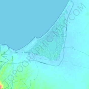
Name: Topografische Karte Coveñas, Höhe, Relief.
Ort: Coveñas, Morrosquillo, Sucre, Colombia (9.35403 -75.71177 9.46868 -75.60287)
Durchschnittliche Höhe: 7 m
Minimale Höhe: -2 m
Maximale Höhe: 124 m
Andere topografische Karten
Klicken Sie auf eine Karte, um ihre Topografie, ihre Höhe und ihr Relief anzuzeigen.
San Onofre
San Onofre, Morrosquillo, Sucre, RAP Caribe, 707017, Colombia
Durchschnittliche Höhe: 40 m