
Topografische Karte Boonton Reservoir
Interaktive Karte
Klicken Sie auf die Karte, um die Höhe anzuzeigen.
Über diese Karte
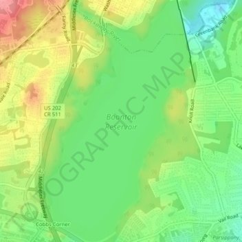
Name: Topografische Karte Boonton Reservoir, Höhe, Relief.
Durchschnittliche Höhe: 102 m
Minimale Höhe: 61 m
Maximale Höhe: 156 m
Andere topografische Karten
Klicken Sie auf eine Karte, um ihre Topografie, ihre Höhe und ihr Relief anzuzeigen.
Parsippany
United States > New Jersey > Morris County > Parsippany-Troy Hills
Parsippany, Parsippany-Troy Hills, Morris County, New Jersey, 07054, United States
Durchschnittliche Höhe: 95 m
Lake Hiawatha
United States > New Jersey > Morris County > Parsippany-Troy Hills
Lake Hiawatha, Parsippany-Troy Hills, Morris County, New Jersey, 07034, United States
Durchschnittliche Höhe: 77 m