
Topografische Karte Santa Monica Mountains
Interaktive Karte
Klicken Sie auf die Karte, um die Höhe anzuzeigen.
Santa Monica Mountains
On January 17, 2007, an unusually cold storm brought snow in the Santa Monica Mountains. The hills above Malibu picked up three inches (eight centimeters) of snow - the first measurable snow in fifty years. Snow was reported on Boney Peak in the winter of 2005; and in March 2006, snow also fell on the summit of the mountain. Snow also fell on the peak of Boney Peak in late December 2008. The latest recorded snowfall in the area was in February 2019, when an unusual amount of snowfall accumulated in low passes in the mountains. That storm system also brought rare snowfall to the Los Angeles area. Heavy graupel was recorded in Malibu Canyon on January 23, 2021. It accumulated as low as 400 feet in elevation.
Über diese Karte
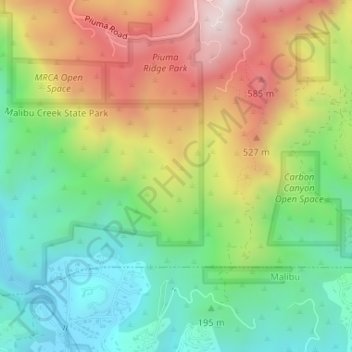
Name: Topografische Karte Santa Monica Mountains, Höhe, Relief.
Durchschnittliche Höhe: 288 m
Minimale Höhe: 8 m
Maximale Höhe: 688 m
Andere topografische Karten
Klicken Sie auf eine Karte, um ihre Topografie, ihre Höhe und ihr Relief anzuzeigen.