
Topografische Karte Lake Lanier
Interaktive Karte
Klicken Sie auf die Karte, um die Höhe anzuzeigen.
Über diese Karte
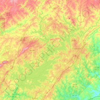
Name: Topografische Karte Lake Lanier, Höhe, Relief.
Durchschnittliche Höhe: 351 m
Minimale Höhe: 233 m
Maximale Höhe: 497 m
According to the Army Corps of Engineers, the Dam has a current installed capacity of 126 megawatts and a hydraulic head of 136 feet. Other pertinent information on the reservoir, power plant, etc. can be found on the Mobile District Corps of Engineers web site.[12][13] Also, historic operational information on lake elevations, discharges, inflows and power generation for all the Corps projects on the ACF are available.