
Topografische Karte Monteagle
Interaktive Karte
Klicken Sie auf die Karte, um die Höhe anzuzeigen.
Monteagle
The town straddles a narrow stretch of the Cumberland Plateau known colloquially as "Monteagle Mountain". This stretch of the plateau is approximately 2 miles (3 km) wide, with steep drop-offs to the northwest and southeast. Monteagle lies at an elevation of just under 2,000 feet (610 m) above sea level. By comparison, two nearby cities, Cowan (to the northwest) and South Pittsburg (to the southeast), lie at elevations of less than 1,000 feet (300 m) above sea level.
Über diese Karte
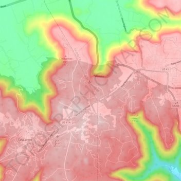
Name: Topografische Karte Monteagle, Höhe, Relief.
Durchschnittliche Höhe: 487 m
Minimale Höhe: 232 m
Maximale Höhe: 621 m
Andere topografische Karten
Klicken Sie auf eine Karte, um ihre Topografie, ihre Höhe und ihr Relief anzuzeigen.