
Topografische Karte Montaña Encantada
Interaktive Karte
Klicken Sie auf die Karte, um die Höhe anzuzeigen.
Über diese Karte
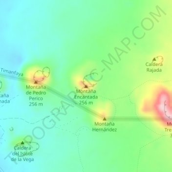
Name: Topografische Karte Montaña Encantada, Höhe, Relief.
Ort: Montaña Encantada, Yaiza, Las Palmas, Canarias, España (28.98891 -13.79759 28.98901 -13.79749)
Durchschnittliche Höhe: 144 m
Minimale Höhe: 77 m
Maximale Höhe: 307 m
Andere topografische Karten
Klicken Sie auf eine Karte, um ihre Topografie, ihre Höhe und ihr Relief anzuzeigen.