
Topografische Karte Toney
Interaktive Karte
Klicken Sie auf die Karte, um die Höhe anzuzeigen.
Über diese Karte
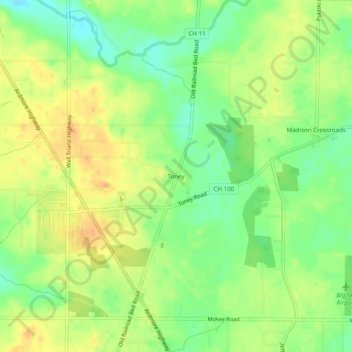
Name: Topografische Karte Toney, Höhe, Relief.
Ort: Toney, Madison County, Alabama, 35773, United States (34.87814 -86.75361 34.91814 -86.71361)
Durchschnittliche Höhe: 255 m
Minimale Höhe: 236 m
Maximale Höhe: 271 m
Toney is an unincorporated community in the northwestern part of Madison County, Alabama, United States. A part of the Huntsville-Decatur Combined Statistical Area, it is located at an elevation of 827 feet (252 m).